SPLASH10-F (Fastloc®) tags are data-archiving, satellite transmitting tags designed for tracking vertical and horizontal movements of free-range marine animals.
A SPLASH10-F tag works best for researchers conducting fine-scale movement studies on diving animals like cetaceans, sea turtles and pinnipeds.
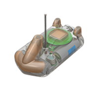
The SPLASH10-F comes in a variety of shapes for a variety of attachments—whatever works best for your animal.
Overview
Fastloc technology is what sets this tag apart. Fastloc uses GPS to provide highly accurate locations in under a second. Fastloc allows for fine-scale locations on animals that surface too quickly for a traditional GPS or Argos fix—Fastloc acquires positions every few minutes compared to a maximum of a few dozen a day with Argos-only tags.
Key Benefits of Fastloc:
- Highly accurate—to 20 m with optimal satellite coverage.
- Fast acquisition—even after prolonged sleep, a location can be acquired in a fraction of a second. Very little surface exposure is needed.
- All acquired GPS snapshots are stored for validation post-download.
- Flexible scheduling—fixes can be scheduled at regular intervals or duty cycled depending on day or season.
- Many locations possible—hundreds of locations achievable per day for a higher resolution track.
Key Features of SPLASH10-F Tags Include:
- Highly Customizable Data Collection and Transmitting Schedule—users can customize and prioritize data transmissions. Deployments can be tailored to achieve unique experimental objectives. Flexible transmissions provide the ability to extend the life of the tag by focusing on specific seasons or times of the year.
- Full Data Archive Available on Recovery—SPLASH10 tags contain one GB of onboard memory for archiving data. This means when you recover your tag, your full data set is available, even if the battery is dead—data are maintained in the archive for up to 25 years.
- Specialized Shapes—SPLASH10 tags come in over 60 shapes and configurations. They contain an array of sensors that gather a myriad of data products.
- The Portal Advantage—SPLASH10 tags are supported by the Wildlife Computers Data Portal, a collection of data management tools and services. Developed specifically for the display and investigation of data from Wildlife Computers tags, the data portal streamlines the processes of acquiring, preserving, and sharing data services. The portal helps collect, prepare, and analyze the data returned from the tag—via Argos or the archive. Data are easily sorted, filtered, searched, uploaded, and shared. You can see a Google Earth display of your deployment track, color-coded to show the relative age of each location. You can also set up a live KMZ to get data into your own monitoring system.
Data Products
Archived Data:
- Depth
- Temperature
- Light
- Wet/Dry
Transmitted Data:
- Light Level Geolocation (GPE3)
- Argos Locations
- Fastloc—Most Recent and Post-dive
- Haulout Duration & Location
- Depth Time Series
- Temperature Time Series
- Profile of Depth & Temperature (PDT)
- Dive PDT
- Time-At-Temperature Histogram (TAT)
- Time-At-Depth Histogram (TAD)
- Behavior Log
- Maximum Dive Depth Histogram
- Dive Duration Histogram
- Percent-Dry Timeline
- 20-Minute Dry Timeline
- Dry-Deep-Neither Timeline
Additional Data Products Available:
- Acceleration 3-Axis Archive
- Stomach Temperature
User Guide/Software
This user guide will give you all the essential information needed for interacting with, configuring, and deploying this tag.
Use Mk10Host for configuring legacy SPLASH tags – Version: 1.27.0002 16-Feb-2024. You must remove any prior versions before downloading.
Installs the Mk10Host program used for communicating with SPLASH tags. Mk10Host allows you to set up the tag’s deployment parameters and download archived data when the tag is recovered.
USB Communications Cable Driver – 29-March 2023
Driver for the Wildlife Computers USB Communications cable.
Wildlife Computers Data Portal—reliable, complete cloud storage for your data.
Tag Portal—convenient online programming for configuring tag settings.
Fastloc GPS
Calculate locations from Fastloc® snapshots, satellite ephemerides, and seed locations. This software is an integrated component of the Wildlife Computers Data Portal and runs exclusively on our Internet servers.
Calculate locations from Fastloc® snapshots, satellite ephemerides, and seed locations. This software is an integrated component of the Wildlife Computers Data Portal and runs exclusively on our Internet servers.
Specifications
Below are the physical specifications of different SPLASH10-F models. A full description of the features is available on the downloadable SPLASH10-F Product Features (PDF).
| Sensors | Depth, Temperature, Wet/Dry, Fastloc (light and accelerometer options)*** |
| Depth Sensor Range | 0-1700 m, 0-2000 m1*** |
| Depth Sensor Resolution | 0.5 m, 1 m1*** |
| Depth Sensor Accuracy | ±1% of reading |
| Temperature Sensor Range | -40 °C to 60 °C |
| Temperature Sensor Resolution | 0.05 °C |
| Temperature Sensor Accuracy | ±0.1°C |
| Light Sensor (When Installed) | 5 x 10-12 W cm-2 to 5 x 10⁻² W cm-2 |
| Operating Temperature Rating (°C) | -20° C to 50° C |
| Optimal Storage Temperature Range (°C) | 0° C to 5° C |
| Conductivity Operational Limits | 0.1 to 5 S m-1 |
| Memory | 1 GB |
| Length (mm), Diameter (mm), Weight (g), Pressure Rating, Maximum Deployment Length | *** |
| 1Meters of freshwater. To convert to dBar, or an approximation for meters of seawater, multiply the reported balue by 0.9804 | |
*** indicates the specification is dependent upon the configuration model
Tag features and specifications subject to change without notice
Antenna length not to scale