Features
- Argos
- Depth
- Temperature
- Light Level
- Accelerometer


WEIGHT
60 g
LIFE
2 years
(maximum deployment length)
DIMENSIONS (mm)
124 x Ø 38
Key Benefits
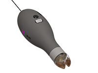
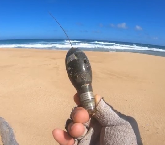
The MiniPAT is a pop-up archival transmitting tag (PAT tag, also known as a PSAT). It is a sophisticated combination of archival and Argos satellite technology.
PAT tags are designed to track the large-scale movements and behavior of fish and other animals which do not spend enough time at the surface to allow the use of real-time Argos satellite tags.
Depth, temperature, and light-level data, among others, are collected and summarized for transmission and archived in onboard memory. Then on a preset date set by the researcher, the tag releases from its host animal, surfaces, and uploads a summary of the archived data to Argos satellites.
Developed with a focus on reliability, ruggedness, and ease of use, the MiniPAT features a stable low-drag shape, a strong urethane nose, and pinger for radio tracking recovery.
Complete Record
Depth, temperature, and light-level readings are stored. A full archive is available upon recovery.
Flexible Programming
Allows researchers to customize and prioritize data transmissions and release parameters.
Corrodible Pin
Allows the release of the MiniPAT from the fish on a pre-programmed date.
Floats to Transmit
Once released, the tag floats to the surface so data can be transmitted.
Radio Tracking
The pinger allows for radio tracking recovery.
Key Features Available in the MiniPat
Auto-Detect Mortality and Tag Detachment — the MiniPAT monitors for constant depth, a state which implies the tag is floating at the surface or sitting on the seafloor. If constant-depth conditions are met, a release is activated. The MiniPAT will transmit even in the event of attachment failure, animal mortality, or unexpected animal behavior.
Auto-Crush-Depth Prevention — a release is triggered if the tag ventures below 1400 meters.
Adaptive Transmission Schedule — Intelligent, responsive software waits until after the pop-up to package data messages for transmission. This allows the tag to send as much data as possible.
The Portal Advantage — The portal helps collect, prepare, and analyze the data returned from the tag — via Argos or the archive. Data are easily sorted, filtered, searched, uploaded, and shared. You can see a Google Earth display of your deployment track, color-coded to show the relative age of each location. You can also set up a live KMZ to get data into your own monitoring system.
The 2019 Northeast Striped Bass Study
With Gray Fishtag Research
On the morning of May 21, 2019, a trophy-hunting team comprised of staff from the nonprofit GrayFishTag Research (GFR), Navionics, and The Fisherman stepped aboard Rocket Charters in lower Manhattan with literally tens of thousands of dollars worth of tagging and electronic gear in hopes of successfully deploying a pair of satellite tags in two post-spawn Hudson River striped bass.
With a quick on-water changeover to Fin Chaser Charters for a double-shift, the team was able to deploy a pair of Wildlife Computer MiniPAT devices to track the large-scale movements and behavior of these fish we named Liberty and Freedom through October 21, 2019, at which point the tags will float to the surface and relay summaries of the stored data via Argos Satellites back to the folks at Gray.
Fisherman Magazine

