12 Jul Processing Fastloc Archival Data
Gaining insight into animal movements is a key component in any study. Once data is collected from a tag during the course of a research study, it is time to process it.
A .wch file recovered from the archive of a Wildlife Computers tag will contain the full dataset from the deployment and is always the best choice for processing Fastloc® locations. Conversely, unprocessed Fastloc data received directly from Argos will likely have missing location data due to short animal surfacing times and the subsequent narrow Argos bandwidth.
Data recovered from tags can be uploaded directly to your Wildlife Computers Data Portal account using the “Upload Data” menu item.
Fastloc Seed Data
The Fastloc location solver, otherwise known as “Locsolve,” relies on known locations to “seed” the software. Unlike Argos-derived data which extracts known locations from the Argos.csv file, archived data does not have the benefit of using known Argos seed locations. Therefore, known locations must be input manually for the Locsolver software to process Fastloc locations.
Known Locations Input
Any known locations should be added to the dataset to enhance Fastloc processing. Deployment location, regular Argos locations, acoustic pinger locations, even known sightings are a few examples. Normally, a location every few days is fine, however, if you are seeing poor data results, consider adding any additional Argos locations to fill in the gaps.
Once the archive .wch file is uploaded to the Data Portal, select the row and then go to the “Metadata” tab:
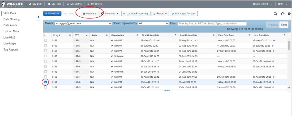
After clicking the Metadata button, the metadata editor window will open for the specific deployment. Selecting the Deployment Dates/Locations tab will take you to the editor where you can enter the Deployment Start and End dates and additional locations. Initially, the Deployment Date and End fields will be blank (read N/A) until you edit each row by clicking the edit button (blue pencil icon).
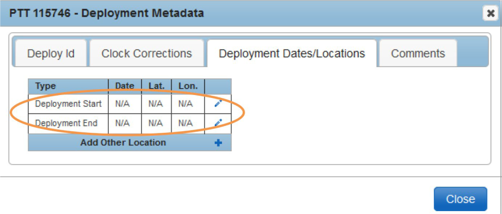
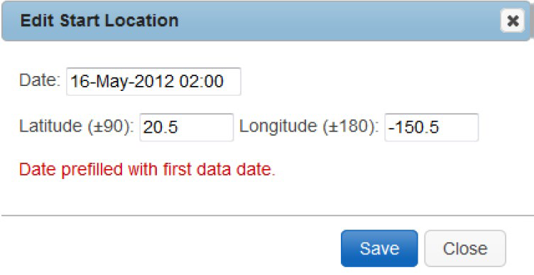
As a convenience, the data portal will use the First Data Date value from your selected row to pre-populate the Deployment Start date for you in the editor.
Now that the information for the Deployment Start has been saved, a red “X” appears next to the edit button (blue pencil) in case you make a mistake and want to enter different data.
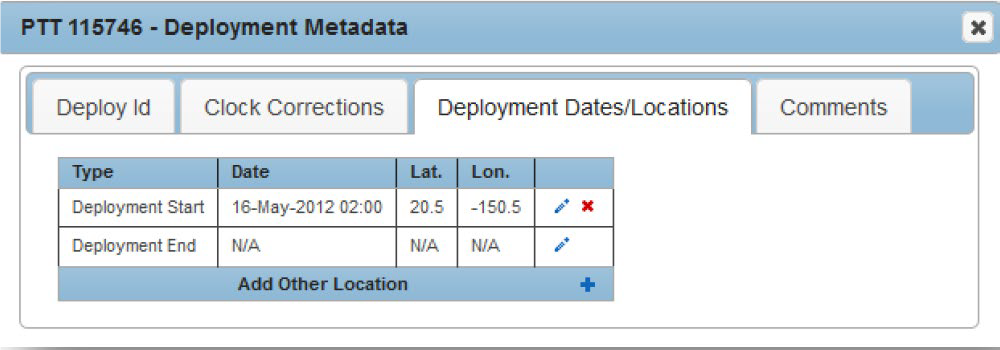
“Add Other Location” can be used to add additional known locations as described above. By entering the start and end dates will help your data run more efficiently and quickly. If you encounter an issue, read the troubleshooting tips below.
Troubleshooting
- A manually input location every few days is normally fine, however, if the results have a gap in Fastloc snapshots, consider adding additional Argos locations around the time of the poor data.
- Carefully check the known locations that are input, particularly to ensure that the polarity of the known location is correct. E.g 663 N vs -39.663 S.
- If the .wch archive file has come from a tag that included an Argos transmitter, check the Status.csv file to ensure that the time on the tag was set to UTC. The time offset column will show the time difference between the satellite and the tag Real-Time-Clock. This correction can be manually added in the metadata via the “Clock Corrections” tab.