03 Apr Revealing Manta Ray Movements with SPLASH Tag Technology
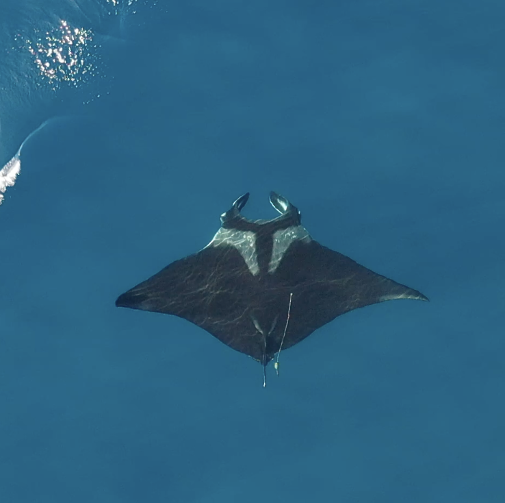
Understanding how oceanic manta rays use coastal habitats has long been a challenge. These wide‑ranging animals spend much of their lives below the surface, often far from shore, making traditional observation methods ineffective. Now, research from Aotearoa New Zealand is changing that picture—thanks to data collected using Wildlife Computers SPLASH10 Fastloc® satellite tags.
In a study published in Royal Society Open Science, researchers tracked the movement ecology and foraging behavior of endangered oceanic manta rays (Mobula birostris) in northeastern New Zealand waters. By deploying SPLASH10-F-321 tags on manta rays during their seasonal presence in the region, the team was able to generate the first fine‑scale picture of how these animals move, dive, and respond to their environment at the southernmost edge of their range.
Seeing Below the Surface with SPLASH Tags
Oceanic manta rays are notoriously difficult to study. They range widely, dive frequently, and spend much of their lives out of sight. SPLASH10‑F tags made this research possible by combining multiple data streams in a single, animal‑borne platform.
Each tag collected:
- Fastloc® GPS positions for fine‑scale movement data whenever mantas surfaced
- Satellite‑linked transmissions, ensuring data recovery even when tags detached far offshore
- Time‑at‑depth and dive profile data, revealing how mantas used the water column day and night
Together, these capabilities allowed researchers to track manta rays for months and follow their movements across coastal and shelf waters—without needing to recover the tags.
High‑Resolution Data, New Ecological Insight
Data from 26 SPLASH10‑F‑321 tag deployments revealed movement and diving patterns that would have been impossible to observe otherwise. While in New Zealand waters, manta rays spent most of their time near the surface, marked by deeper dives exceeding 300 meters. Dive behavior varied predictably with time of day, moon phase, and environmental conditions.
GPS data also showed strong links between manta movements and shallow coastal bathymetry. Nearly all locations occurred within the 200‑meter isobath, with repeated use of productive channels in the Hauraki Gulf. By pairing movement data with environmental variables such as wind, temperature, and water clarity, researchers were able to identify conditions associated with likely foraging behavior.
Crucially, SPLASH tags captured horizontal movements and vertical behavior simultaneously, allowing scientists to connect where mantas went with how they behaved—a key step in understanding habitat use.
Beyond Borders and Conservation Impact
Although this study focused on coastal New Zealand, SPLASH10 technology has also documented dives exceeding 1,300 meters and long‑distance migrations into the tropical Pacific. Even when tags detached during migration, satellite transmission ensured valuable datasets were recovered.
Oceanic manta rays are listed as Endangered, and in New Zealand their status has been limited by data gaps. By revealing where mantas spend time, how they forage, and how their behavior responds to environmental conditions, SPLASH tag data is helping inform evidence‑based management.
This research highlights how Wildlife Computers SPLASH tags transform hidden movement into actionable insight, supporting both cutting‑edge science and the conservation of vulnerable marine species.
Picture courtesy of Mark Erdmann