15 Dec New Portal Update Offers Improved Locations and Faster Processing
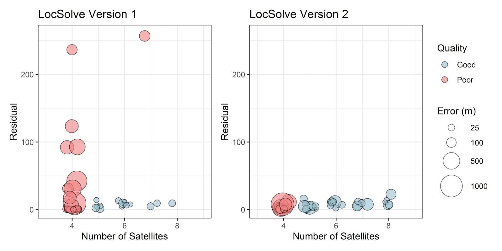
 LocSolve™, the proprietary software used to post-process Fastloc® GPS data, received a significant upgrade in the Wildlife Computers Data Portal.
When a tag on a marine animal breaks the water’s surface, it acquires a snapshot of signals from the detected GPS satellites. The tag then uses onboard processing to produce a “pseudo-range” for each satellite. LocSolve uses the pseudo-ranges and time of reception to estimate the animal’s location by minimizing the range residuals into a “least squares” solution. This results in a single point and time on the earth’s surface (latitude/longitude).
This new version of LocSolve improves the location estimates, especially for locations with four and five satellites, and processes locations ~170 times faster.